Topographic survey

We provide precise topographic surveying services using advanced 3D laser scanning technology to capture detailed elevation data, terrain features and site conditions for accurate land mapping and planning.
Montreal drone scan, topographic quebec
Topographie

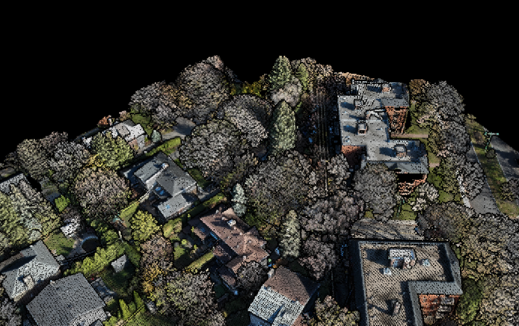
Using our DJI matrix 350 drone equipped with LiDAR L2 sensor technology, we carry out high-resolution topographic surveys with up to five returns per laser pulse, enabling us to extract a precise point cloud that accurately differentiates vegetation, water bodies and ground surfaces. This multiple-return capability enables us to accurately map dense forest canopies, rugged natural landscapes and built-up environments, even in areas with complex terrain or dense foliage. By combining aerial photogrammetry and LiDAR scanning, we generate detailed, colorful digital elevation models (DEMs) and terrain analyses with sub-centimeter accuracy.

Drone montreal
Deliverables - compatible with GIS and CAD software
1. High-resolution topographic maps
Whether for site grading, hydrological analysis, forest management or infrastructure planning, our drone surveys offer an unrivalled level of accuracy and efficiency in topographic data collection.
2. Georeferenced orthophotos
We also provide in-depth studies based on the data collected: contour maps, thermological altitude maps and hydrological simulations.
3. 3D terrain models
3D terrain models capture detailed elevation and surface features, providing an accurate digital representation for topographic analysis, planning and design.
4. LiDAR point clouds
Provides dense, geo-referenced spatial data, enabling precise terrain mapping, elevation modeling and structural analysis for topographic surveys.
scan it. Plan it. perfect it.

Let's bring your vision to life.